★ REP YOUR TOWN ★ HOMETOWN GEAR ★ PRINTED TO ORDER ★ WHERE YOU FROM? ★ REP YOUR TOWN ★ HOMETOWN GEAR ★ PRINTED TO ORDER ★ WHERE YOU FROM? ★ REP YOUR TOWN ★ HOMETOWN GEAR ★ PRINTED TO ORDER ★ WHERE YOU FROM? ★ REP YOUR TOWN ★ HOMETOWN GEAR ★ PRINTED TO ORDER ★ WHERE YOU FROM? ★ REP YOUR TOWN ★ HOMETOWN GEAR ★ PRINTED TO ORDER ★ WHERE YOU FROM? ★ REP YOUR TOWN ★ HOMETOWN GEAR ★ PRINTED TO ORDER ★ WHERE YOU FROM?
Damaged in shipping or misprinted? Free replacement. Details
The Ridgeline design from our Jackson, Tennessee collection, on a mug.
Glossy ceramic, in white or with a colored inside and handle
Design printed on both sides
Microwave and dishwasher safe
Printed to order in the USA
What's on this mug
This one is real data. We took elevation data for a 20 x 20 mile square centered on downtown Jackson, sliced it into west-to-east profiles, and stacked them from north to south. Every bump on every line is actual terrain, smoothed a little so the lines print clean.
Inside the square, the ground runs from about 321 feet to about 645 feet, roughly 300 feet of relief. The rolling rise and fall comes from low hills like Norton Hill and Mount Pinson, cut through by the Middle Fork Forked Deer River.
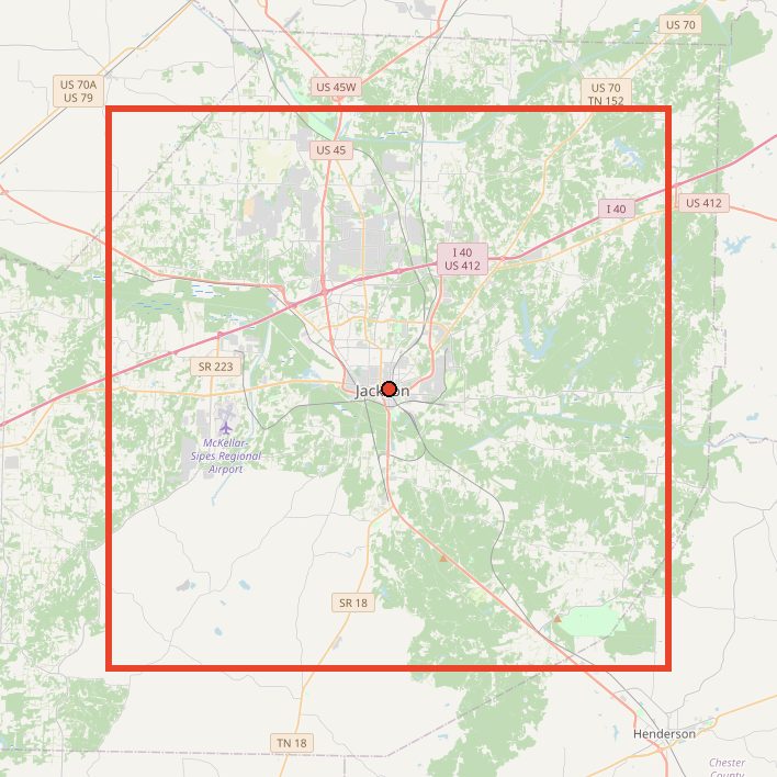
Yes. Each line is a real west-to-east elevation profile across a 20 x 20 mile square centered on downtown Jackson. The map on this page shows the exact area.
Jackson doesn't look hilly. Where do the peaks come from?
The lines are scaled so you can see small changes. The rise comes from low hills like Norton Hill and Mount Pinson, with the Middle Fork Forked Deer River cutting through the flatter ground.
What size is it?
Two sizes: 11oz $22, 15oz $26.
What colors does it come in?
11 colors: Black, White, Light Blue, Navy, Maroon, Red, Orange, Yellow, Purple, Light Green and Pink.
How is it made?
Glossy ceramic, in white or with a colored inside and handle. Design printed on both sides. Microwave and dishwasher safe. Printed to order in the USA.
Can I return it?
Each one is made to order, so we can't take returns for a change of mind. If it arrives damaged or misprinted, tell us within 30 days with a photo and we'll replace or refund it, free.