★ REP YOUR TOWN ★ HOMETOWN GEAR ★ PRINTED TO ORDER ★ WHERE YOU FROM? ★ REP YOUR TOWN ★ HOMETOWN GEAR ★ PRINTED TO ORDER ★ WHERE YOU FROM? ★ REP YOUR TOWN ★ HOMETOWN GEAR ★ PRINTED TO ORDER ★ WHERE YOU FROM? ★ REP YOUR TOWN ★ HOMETOWN GEAR ★ PRINTED TO ORDER ★ WHERE YOU FROM? ★ REP YOUR TOWN ★ HOMETOWN GEAR ★ PRINTED TO ORDER ★ WHERE YOU FROM? ★ REP YOUR TOWN ★ HOMETOWN GEAR ★ PRINTED TO ORDER ★ WHERE YOU FROM?
Stacked ridgelines traced from real elevation data across a 20-mile square around downtown Jackson, with the city's coordinates set underneath. The low hills and creek bottoms of West Tennessee, drawn as clean lines. One-color print that works on any shirt.
Heavyweight 100% cotton
Classic unisex fit
What's on this shirt
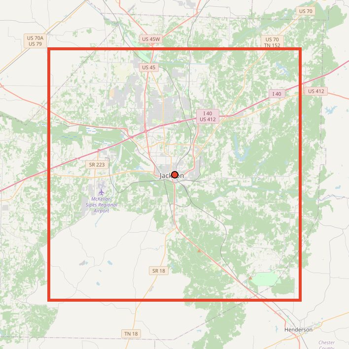
This one is real data. We took elevation data for a 20 x 20 mile square centered on downtown Jackson, sliced it into west-to-east profiles, and stacked them from north to south. Every bump on every line is actual terrain, smoothed a little so the lines print clean.
Inside the square, the ground runs from about 321 feet to about 645 feet, roughly 300 feet of relief. The rolling rise and fall comes from low hills like Norton Hill and Mount Pinson, cut through by the Middle Fork Forked Deer River.
Gift idea: For anyone who likes a design with a story behind it.
Questions about this shirt
Is this made from real elevation data?
Yes. Each line is a real west-to-east elevation profile across a 20 x 20 mile square centered on downtown Jackson. The map on this page shows the exact area.
Jackson doesn't look hilly. Where do the peaks come from?
The lines are scaled so you can see small changes. The rise comes from low hills like Norton Hill and Mount Pinson, with the Middle Fork Forked Deer River cutting through the flatter ground.
What sizes and colors does it come in?
Sizes S to 3XL in 12 colors: Black, Natural, Sand, White, Sport Grey, Ash, Light Blue, Navy, Forest Green, Maroon, Military Green, Charcoal. Every size is $29.
How is it made?
Heavyweight 100% cotton, classic unisex fit. Each shirt is printed to order in the USA when you buy it.
Can I return or exchange it?
Each shirt is printed to order, so we can't take returns or exchanges for size or a change of mind. If it arrives misprinted or damaged, tell us within 30 days with a photo and we'll replace or refund it, free. Check the size chart above before you order.
Get outside in Jackson
Cypress Grove Nature Park ↗A mile-long boardwalk winds through a cypress swamp to Wood Duck Lake, with the Rockwell Observation Tower and an Aerie Trail Raptor Center along the way.
Middle Fork Bottoms State Park ↗An 850-acre nature area with nearly five miles of paved trails, kayaking, and a 10-acre stocked fishing lake, right in Jackson.
Wooded Trail System at Union University ↗Over six miles of shaded trails through 100 acres of wooded hills, open to the public for hiking, running, and mountain biking.
Pinson Mounds State Archaeological Park ↗Just outside town, home to Sauls Mound, the tallest Middle Woodland mound in the country, with quiet trails through the site.