★ REP YOUR TOWN ★ HOMETOWN GEAR ★ PRINTED TO ORDER ★ WHERE YOU FROM? ★ REP YOUR TOWN ★ HOMETOWN GEAR ★ PRINTED TO ORDER ★ WHERE YOU FROM? ★ REP YOUR TOWN ★ HOMETOWN GEAR ★ PRINTED TO ORDER ★ WHERE YOU FROM? ★ REP YOUR TOWN ★ HOMETOWN GEAR ★ PRINTED TO ORDER ★ WHERE YOU FROM? ★ REP YOUR TOWN ★ HOMETOWN GEAR ★ PRINTED TO ORDER ★ WHERE YOU FROM? ★ REP YOUR TOWN ★ HOMETOWN GEAR ★ PRINTED TO ORDER ★ WHERE YOU FROM?
Damaged in shipping or misprinted? Free replacement. Details
The Street Map design from our Clarksville, Tennessee collection, on a long sleeve t-shirt.
100% cotton (heather colors are blends)
Ribbed cuffs
Classic unisex fit
Printed to order in the USA
What's on this long sleeve t-shirt
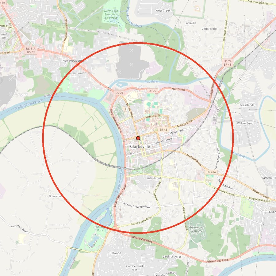
Drawn from real map data: every street inside a 3.2 mile circle centered on downtown Clarksville, with the Cumberland River along its western edge. That is 257 named streets in one circle.
The circle takes in downtown along streets like College Street, Kraft Street and North 2nd Street, the riverside drives of North and South Riverside, Madison Street, Providence Boulevard and University Avenue, with the Cumberland River, Red River and West Fork Red River running through it, plus Freedom Point at Liberty Park.
Yes. The streets and rivers come from real map data for a circle about 3.2 miles across, centered on downtown Clarksville. The map on this page shows the exact area.
What's included on the map?
Downtown Clarksville's street grid, the Cumberland, Red and West Fork Red rivers, and Freedom Point at Liberty Park.
What sizes and colors does it come in?
Sizes S to 3XL in 9 colors: White, Sport Grey, Ash, Light Blue, Black, Navy, Forest Green, Light Pink, Dark Heather. Every size is $34.
How is it made?
100% cotton (heather colors are blends). Ribbed cuffs. Classic unisex fit. Printed to order in the USA.
Can I return it?
Each one is made to order, so we can't take returns for a change of mind. If it arrives damaged or misprinted, tell us within 30 days with a photo and we'll replace or refund it, free.